Home
Factbook
Geography
History
People
Symbols
Government
Defense
Diplomacy
Economy
Contact
Tech Area
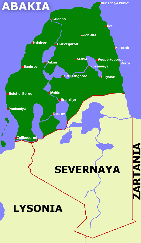
GeographyThe Abaki Soviet is located on the northernmost tip of the continent of Eras, bordering the Lyson Empire and the non-consolidated territories of Severnaya.
Official map of the Abaki Soviet, showing the major cities.The majority of the population is concentrated along the southwestern coast and arround Smirnov Lake. On these regions, the climate is warmer. On most other areas, temperatures may reach as low as -35°C on the winter.
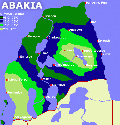
Climate areas of Abakia, with the average summer and winter temperatures.The terrain of Abakia is made of the Great Western and Eastern Plains, while the central, northern and southern areas of the country are dominated by pine-covered hills - none reaching more than seven hundred meters - plus the valleys formed by the Red Sky Lakes and its rivers. On the southwestern coast, we find the volcanic islands of the Lakumi Archipelago, negleted by many - it didn't even appear on any map since 297! - and rightfully claimed by the Abaki Soviet.
During the winter months, virtually all of the country is covered in snowfields for at least some weeks.
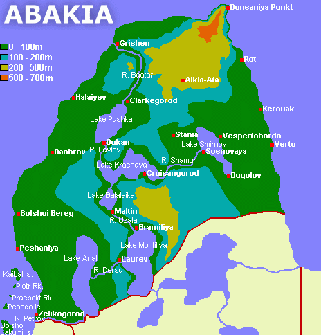
Topographic map of the Abaki Soviet.The Red Sky Lakes are the most important geographic feature of Abakia. These bodies of water were formed on the end of the last Ice Age, with the melting of the great ice caps [ TECH: Just like the North American Great Lakes ]. The lakes and the rivers conecting them are prime components of the Abaki daily life, being the nation's main transport routes, source of a great part of our people's food and a popular tourist destination for foreigns.
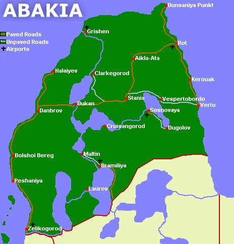
Abaki transportation network. Due to the limited number of roads, most of the transport is done through waterways.